This post describes how aircraft positional data derived from Air Traffic Control (ATC) ground-based radar surveillance systems could be used on-board the aircraft:
a) To navigate the aircraft;
b) To improve the accuracy and availability of the aircraft navigation systems (VOR, DME, GPS, INS, etc.);
c) As a back-up of the aircraft navigation systems; and
d) For aircraft navigation systems integrity monitoring.
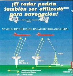
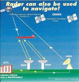
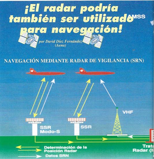
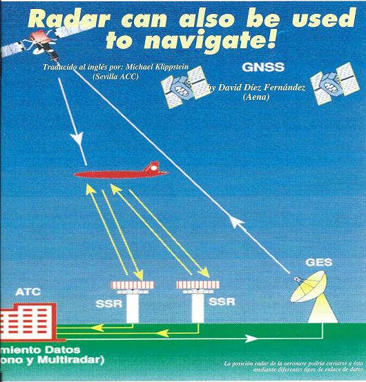
In the same way that ATC uses data derived from on-board navigation systems for surveillance purposes (ADS), we should consider as well the possibility of using aircraft positional data derived from ATC ground-based radar surveillance systems (SSR, Mode S, PSR, etc.) for navigation purposes, in what we could call Surveillance Radar Navigation (SRN).
The fact is that ATC surveillance radars have already been used indirectly, since long time ago, for navigational purposes in those cases where air traffic controller s assuming the navigation of aircraft direct them by means of radar vectoring or by giving them distance information with respect to the glide path or localizer of a virtual ILS (GCA, PAR).
SRN could be defined as follows:
Surveillance Radar Navigation is a function for use by aircraft flying under ATC ground-based radar and data link coverage in which the ground system automatically transmits, via a data link, data derived directly from radar stations or from radar data processing systems (RDPSs). As a minimum, the data includes the aircraft identification and its two dimensional position (longitude, latitude) as determined by radar. Additional data (speed as calculated by the ground system, altitude as determined by radar (PAR, GCA, etc.) may be provided as appropriate.
SRN messages could be exchanged between ground and air via a variety of data links (Mode S, very high frequency, satellite, etc.)
One of the advantages of SRN is that is a selective navigation system where the navigational data is only sent to those aircraft known by the ground system, and if necessary, in times of tension, crisis or war, SRN data could be limited to those aircraft properly identified as friends and authorized to receive the data. Therefore there is no reason to disable this system, although GPS or other navigation systems might have to be disabled, because those could be used by unauthorized traffic (foes).
The utilization of ATC surveillance radar systems for the dual purpose of surveillance and navigation would permit the early withdrawal of a large portion of the ground-based navigation aids in the radar coverage area, and consequently reduce the expenses of the air navigation system while still maintaining a ground based navigation system, which is selective, to back-up GNSS (GPS, etc.). In addition, its integration on-board with GNSS would increase availability, sometimes accuracy, and would allow for the integrity monitoring of GNSS.
The above concept of using radar surveillance for aircraft navigation is not new.
A working paper (FANS/4-WP35) titled “POSSIBLE USE OF SSR MODE S RADAR FOR NAVIGATION PURPOSES”, prepared by David Diez, was presented to the 4th meeting of the SPECIAL COMMITTEE ON FUTURE AIR NAVIGATION SYSTEMS (FANS) of ICAO, which was held in Montreal, Canada, from the 2nd to the 20th of May 1988.
The FANS Committee took note of the paper content, but did not take any specific action on this matter.
Click here to see FANS/4-WP35
It was not until five years later, that a second working paper (FANS (II)/4-WP20) on Surveillance Radar Navigation (SRN), was presented by David Diez to the 4th meeting of the ICAO FANS II Committee which was held in Montreal from the 15th of September to the 1st of October 1993.
Click here to see FANS(II)/4 WP20 in English
Click here to see FANS(II)/4 WP20 in Spanish
Click here to see FANS(II)/4 WP20 in French
The FANS II Committee considered that due to its potential the idea (SRN) should be deeply investigated, and decided to include the action in the “list of tasks” which the Committee considered necessary to successfully implement the FANS Concept ,better known as ICAO CNS/ATM systems.
Click here to see FANS(II)/4 meeting attendance list
Various references to SRN exist in the FANS (II)/4 Report (ICAO Doc 9623), where one also can find in Appendix A of Item4, the “list of tasks” mentioned previously. In the Report concerning Ítem 5 of the Agenda, paragraph 5.8.3, one can read: “the integration of data from ground surveillance radar in the cockpit with the objective of improving on-board navigation could lead to further CNS/ATM systems benefits”
Click here to see the part of the “list of tasks” related to SRN
Click here to see Item5, paragraph 5.8.3
Following the FANS (II) Committee recommendation with respect to SRN, in 1994, the Commission of the European Communities, included task A.3.2.3 Surveillance Radar Navigation (SRN) in its EUROPEAN COHERENT APPROACH FOR RTD IN ATM (ECARDA) initiative.
Click here to see an extract of the ECARDA document describing task A.3.2.3
Unfortunately task A.3.2.3 was never carried out; probably due to a lack of funding.
The task with respect to SRN established by the ICAO FANS II Committee in 1993 is still pending to be carried out.
It seems that in Europe, may be SESAR as successor of ECARDA would be the most appropriate body to deal with it and retake task A.3.2.3 possibly
Click bellow to see article on SRN
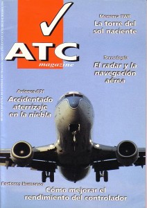
ATC Magazine Nº 10 OCTOBER / DECEMBER 1996
Navegación mediante Radar de Vigilancia / Surveillance Radar Navigation (SRN)
Note: David Diez was the member for Spain of the ICAO FANS II Committee
Remarkable! Its genuinely aesome post, I
have got much clear idea on the topic of from this piece of writing.
biaya kuliah unas kelas karyawan